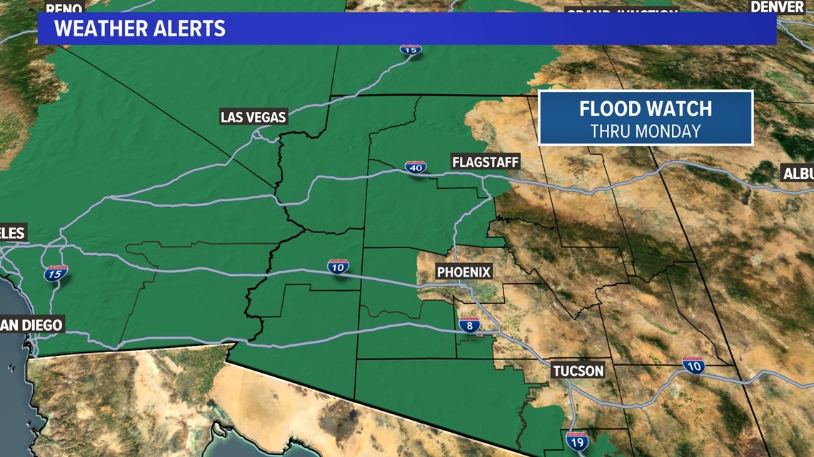
Flooding is most likely across western Arizona, including Yuma, La Paz and Mohave counties.
PHOENIX — The combination of the monsoon and tropical moisture from Hurricane Hillary will create a weather event that will significantly impact 48 states this weekend.
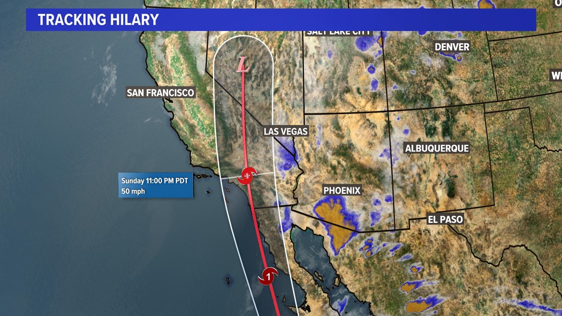
Hillary made landfall on the Baja coast and is expected to move to Southern California late this weekend or early next week.
Flooding is most likely across western Arizona, including Yuma, La Paz and Mohave counties. A flood watch has been issued for the western half of Arizona through Monday as heavy rain is expected over the next few days and conditions remain favorable for flooding.
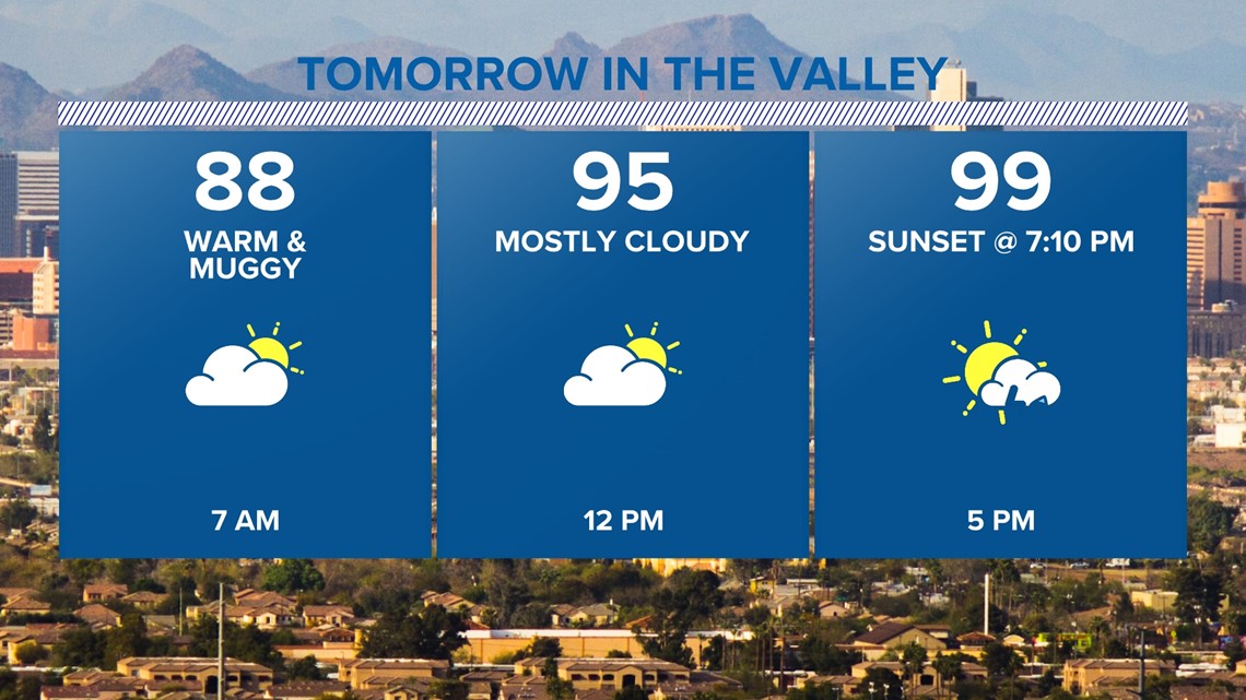
There won't be a washout in the Valley this weekend.
In fact, there will be a lot of dry time, especially on Saturday.
The day will start out hot, humid and dry with cloudy skies. The chance of thunderstorms increases in the late afternoon into early evening, with the potential for severe storms. The biggest severe weather threats include localized flash flooding in the valley late Saturday, damaging wind gusts and blowing dust.
When it comes to the amount of rainfall, there will be a very sharp difference between regions that experience a lot of rain and flooding and regions that experience none at all.
Western Arizona will likely see a few inches of rain over the weekend, but the further east you go in Arizona, the less rain you'll get.
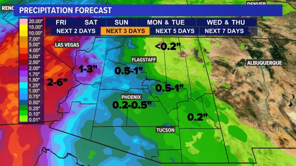
This weekend, the Valley is expected to see more dry spells, and eastern Arizona is expected to see even more dry than rainy hours. Here's the forecast for precipitation through Monday:
Widespread areas of 1 to 3 inches are expected across western Arizona, including Yuma, La Paz and Mohave counties. The worst effects this weekend will be felt across Southern California, where catastrophic flooding is likely.
Much of southern California will see 2 to 6 inches, with some localized areas seeing up to 10 inches. Many areas in western Maricopa County, including Flagstaff, Prescott, Grand Canyon and Gila Bend, will see bands of 0.5 to 1 inch of rain.
Phoenix will likely see 0.2 to 0.5 inches this weekend, while much of eastern Arizona will be in the 0.2 inch range. It's always possible that these numbers will be locally higher due to severe thunderstorm activity, but these are the typical ranges for the weekend.

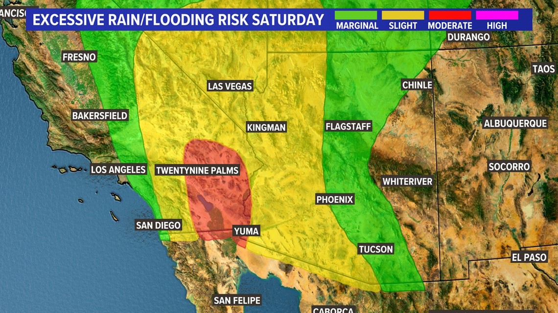
In terms of excessive rain and flooding risk, areas in yellow have a 15% chance of exceeding flash flood guidance on Saturday, which includes the western half of the state. Green areas have a 5% chance of falling.
Here is the same map from Sunday. Areas along the Colorado River marked in red have a 40% chance of exceeding flash flood guidance on Sunday. Yellow areas have a 15% chance and green areas have a 5% chance.
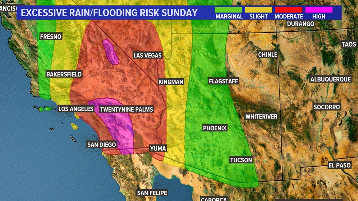
As Hillary makes landfall in Baja and southern California on Sunday and Monday, the chance for rain and storms increases across Arizona. It looks like we'll have the most rainy days this weekend.
arizona weather
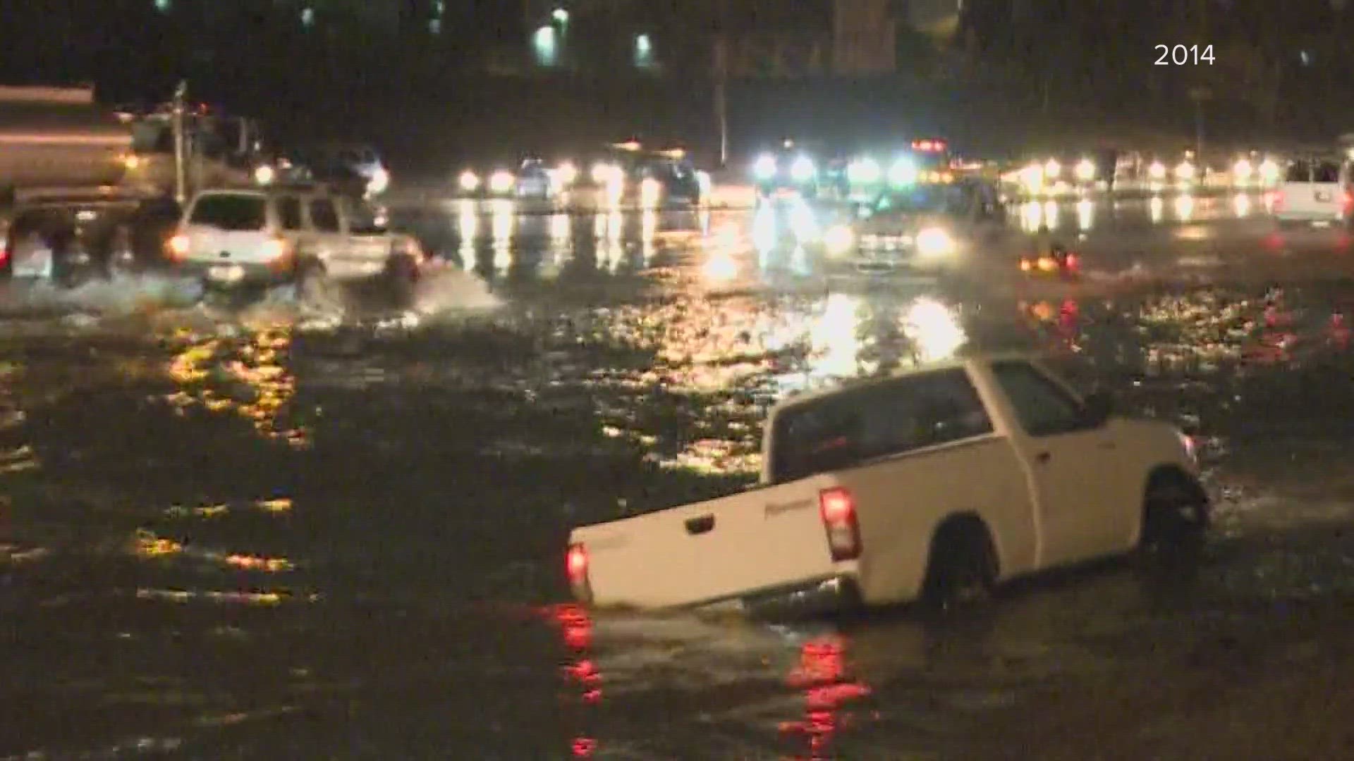
Arizona has seen some pretty bad weather. Here is a collection of videos from various storms across the Grand Canyon State.