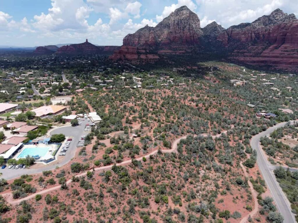
Following the controversy over a proposal by the city of Sedona to use part of Sedona Cultural Park as a car camp for homeless workers, and public questions about the best use of the $23 million site, Sedona residents are beginning to ask how much land the city owns and where it is located.
According to Yavapai and Coconino County property records as of June 17, the City of Sedona owns a total of 107 parcels totaling 657.4 acres in both counties with an estimated cash value of $67,088,084. Of those parcels, 36 parcels, 45 acres, valued at $9,710,882, are located in Coconino County, while the remaining 71 parcels, 612.4 acres, valued at $57,377,202, are located in Yavapai County.
Coconino County property records do not contain any information about the city property at 125 SR 89A, the former Chevron station at the “Y” intersection, and it does not appear in the county parcel viewer. Coconino County GIS Services confirmed that the property was reclassified as a right-of-way in 2007 when it was transferred from Arroyo Roble Marketplace LLC to the Arizona Department of Transportation.
Dells
The City's largest individual property, which makes up the majority of the City's real estate portfolio, is the Dells Site, located in unincorporated areas of Yavapai County, a portion of which is currently used as the City's wastewater treatment plant. The Dells Site consists of 10 parcels totaling 406.2 acres. Three of these parcels, totaling 225.6 acres, are located south of SR 89A and are currently used solely for the disposal of the City's treated wastewater through an irrigation system, but are recommended for replacement with injection wells in the FY2025 Budget.
City Park
The city park has a total area of 104.8 acres and is comprised of:
- Posse Grounds Park, Sedona's original rodeo and public park destination, is comprised of 46.8 acres divided into two parcels and valued at $5,048,918.
- Sedona Cultural Park consists of eight numbered lots covering 40.8 acres, excluding roads. The city purchased the park in December 2022 for $23-24 million, including interest, and designated it as a park in December 2023.
- Sunset Park, single parcel of 7.9 acres, valued at $4,593,467.
- Jordan Historic Park, which contains the Sedona Heritage Museum, consists of two parcels totaling 4.8 acres and valued at $2,319,143.
- Ranger Station Park is currently being built on a single 3.5 acre parcel valued at $798,180.
- Sedona Botanical Gardens is a single 0.6-acre parcel at the southeast corner of State Highway 89A and Arroyo Piñon Drive, assessed at $500.
- Jack Jamesen Memorial Park, single parcel of 0.36 acres, valued at $113,575.
The area of Graybuck Park Pocket Park is included within the city right-of-way on Dry Creek Road.
Right of way
The city's right-of-way parcels total 44.3 acres: 10.9 acres on Soldier Pass Road, 8.9 acres on Airport Road, 8.6 acres on Upper Red Rock Loop Road, 3.6 acres on Hillside Vista Drive, 2.2 acres each on Back of Beyond Road and Dry Creek Road, 2.1 acres on Roadrunner Drive, 2 acres on Shelby Drive and 1.8 acres on Goodrow Lane. The cash value of the right-of-way parcels is typically listed as either $0 or $500.
others
The City’s other land holdings include:
- Two parcels (totaling 32 acres) at 20 Carruth Drive adjacent to Posse Grounds Park. Assessed at $1,774,166. Currently unused.
- Two parcels in the Sierra Vista area of Uptown, totaling 18.2 acres and assessed at $1,409,099, currently unused and designated as open space.
- 555 Soldier Pass Road, 10-acre single parcel, assessed at $703,796. Currently unused and zoned residential.
- 2070 Buena Vista Drive, a single parcel of 8.5 acres, valued at $666,518. Currently unused and designated as open space.
- A single 6.9-acre parcel adjacent to 20 Carruth Drive. Assessed at $613,677. Currently unused and zoned residential.
- Five parcels in the Jordan Park Glen neighborhood of Uptown, totaling 5.8 acres and assessed at $8,401.
- 102 Roadrunner Drive, 3.7 acres, single parcel, valued at $10,506,241, city hall location.
- Three contiguous parcels adjacent to Brewer Road and SR 89A, totaling 2.9 acres and assessed at $1,524,395, currently unused and earmarked for construction of a new road and bus stop.
- 220 Sunset Drive, a single 2.5-acre parcel valued at $1,379,854, recently acquired by the city after the developer of the proposed 46-unit Sunset Lofts project failed to begin construction.
- The two parcels, 2250 Shelby Drive and 2260 Shelby Drive, total 1.9 acres and are assessed at $1,659,057. Currently zoned industrial, 2250 Shelby has been earmarked by city staff for the construction of a three-story, 30-unit apartment building through the Villas on Shelby public-private partnership.
- 260 Schnebly Road – eight parcels totaling 2 acres, assessed at $728,609. Currently an Uptown municipal parking lot.
- 401 Jordan Road, 1.75 acre lot, valued at $1,047,156. Formerly home to the Sedona Chamber of Commerce. Currently used as a parking lot.
- The two parcels at 430 and 460 Jordan Road total 1.2 acres and are assessed at $526,756. They are currently earmarked for the site of the future Uptown Garage.
- 50 Sinagua Drive, a single 0.6-acre parcel adjacent to City Hall, assessed at $579,709. Currently unused.