Severe Weather Alert for Mid-Atlantic Region
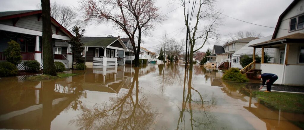
A strengthening low-pressure system is set to impact the Northeast, potentially bringing “significant” coastal flooding to parts of the mid-Atlantic on Sunday and Monday. In response, New Jersey has declared a state of emergency ahead of the storm.
The combination of persistent northeasterly winds and elevated tides is expected to generate waves along the East Coast, stretching from Virginia to New England. Current forecasts indicate that most flooding could affect the coasts of New Jersey and Delaware, especially near Delaware Bay.
A coastal flood watch is in effect for Sunday and Monday, with waves projected to reach between 12 to 15 feet. Some locations may experience tides 2 to 4 feet higher than normal.
Forecasters highlighted the increasing likelihood of moderate to severe coastal flooding during a briefing on Friday. They noted that widespread flooding, impassable roads, building inundation, and potential evacuations are all possible from Sunday into Monday.
A state of emergency has been declared for all 21 counties starting 10 PM Saturday. A nor’easter is anticipated to bring heavy rain, strong winds, and potential flash flooding through the weekend. New Jersey residents should remain alert and safe!
Forecasts suggest that high waves could lead to significant dune damage and coastal erosion. Additionally, a high wind watch remains in effect from Long Island down to the New Jersey and Delaware coasts, with wind gusts potentially reaching 90 mph and sustained winds of 25 to 35 mph.
Heavy rainfall may also trigger flash flooding further inland, with coastal areas possibly receiving 3 to 5 inches of rain by Tuesday. The National Oceanic and Atmospheric Administration has issued a Level 2/4 flash flood risk for regions stretching from Norfolk, Virginia to Philadelphia, New York City, and Southern New England.